Running the length of the highest range is the
223 kilometre Larapinta Trail. It is a tough 8-10 day trek, especially now in
the dry season where temperatures on the escarpments can exceed 50C and water
stops are few and far between. The many gorges that carve their way through the
rock contain cool ground water all year round, fantastic for an icy refreshing
dip to escape the heat of the day.
We spent a pleasant day exploring a number of
the gorges on our route, but unfortunately lack of time prevented us taking on
the 223 km trail – maybe next year!!
Stopping to stretch our legs at Simpsons Gap, a dry river bed and
gorge in the escarpment, we spotted black footed rock wallabies hopping between
the boulders.
We arrived late at Ellery Creek Big Hole and forwent dinner as we
needed our bed. The Aboriginal name for Ellery Big Hole is Udepata, and the
permanent spring water made it a special meeting place for the Arrernte
aboriginal people.
The weather had clouded over and during the night we heard a
sprinkle of rain, our first since arriving in Australia. It really was just a
tiny spit, and evaporated on contact with the window. We took an early morning
stroll along a leisurely circular route, which showcased the dolomite and
sandstone bedding. It was interesting to be in a different environment to that
of Kakadu. This was desert country where Spinifex dominated the floor. These
javelin and spear grassy hummocks seemed like armies of echinoids posed for
battle.
At its western end, the MacDonnell Ranges give
way to the flat plains of the Gibson Desert. At the Tylers Pass Lookout, the
last highpoint on the road, we could see across 20km of desert to a 5km long
crater-like shape thrusting out from the desert sands below. This is Gosse
Bluff, the remnants of a meteorite or comment impact dating back to 140 million
years. The original impact crater was 20km across and has long since eroded
away. The rocks that remain are those that were 5km below the surface when the
celestial object struck, contorting and twisting them upwards due to the high temperatures
and pressures – an impressive sight.
From here its possible to travel straight to
Kings Canyon and Uluru by unsealed roads, but as we didn’t have a 4x4 we had to
go the long way round back via Alice Springs, a 500km detour!
On our way back towards Alice Springs we
visited the Desert Park, a nature reserve where they focus on conserving many
of the endangered species from the Central Australian region. Australia has the
highest extinction rate of any country, predominantly due to the introduction
of many foreign species such as cats, dogs, rabbits, cane toads and camels,
which either hunt native species or compete for the same food sources.
The park was very informative with displays and
talks allowing us to get up close and personal with some of the more shy and
nocturnal species that inhabit this parched desert region.
Striking geography of the MacDonnell Ranges as we approached from Alice Springs

Simpsons Gap is one of the first gorges you reach, cleaving through the ridge

Sort of stating the obvious - no water!

A black footed wallaby, only found in these ranges


The cicadas even survive in the deserts around here

Scub and spinifex dominate the area, the greener vegetation covering the zone where the dolomite and sandstone beds meet, where groundwater comes to the surface.

Cycads can be found in these oases these are some of the earliest plants that appeared on land over 280 million years ago

There are a few stranger sights in these habitats too
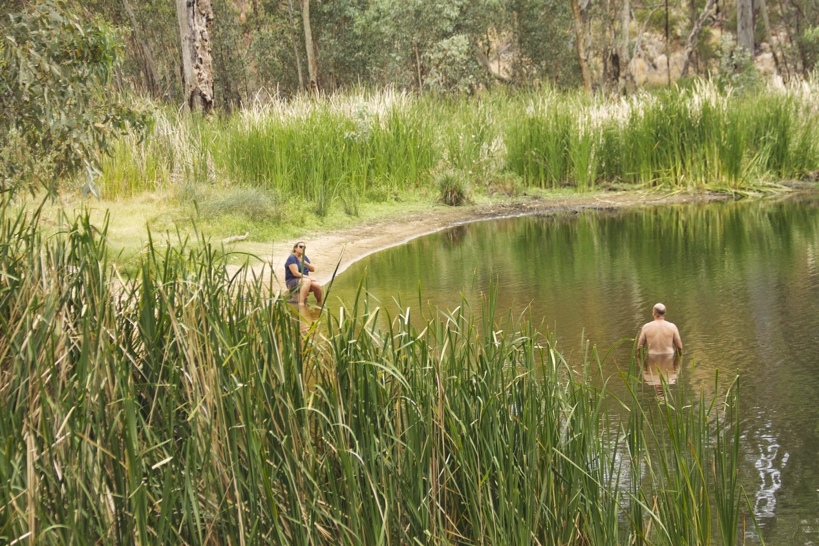
Shrimps thrive in the cold fresh water pools

We also visited the ochre beds, these iron hydroxide rich rocks range in colour from deep red to a bright yellow. This a very important aboriginal site, these ochres would have been traded with other tribes for items such as flint or other materials they couldn't find nearby


Perentie - a type of monitor lizard

Gosse Bluff - the remains of an impact crater from a comet some 140 million years ago

Another Perentie - I think?

A very obedient Barn Owl performs for us for mouse tails - yum!


Although he did need a few words of encouragement

A bush stone curlew - first time we'd seen one in daylight, our camera trap caught a picture of one at Edith Falls at night

Black Kite in flight


Whistling Kite

Thorny Devil

A very chilled out Red Kangaroo

A Red-Tailed Black Cockatoo

Superbe! Magnifique! Je suis presque jaloux :)
ReplyDeleteWhy is Sarah watching a naked old man?
ReplyDelete